History of Harwich & Dovercourt
Harwich is not mentioned in the Domesday Book so at that time if anyone lived there it must have been a very small settlement. (The name Harwich is believed to be derived from the old words here wic, meaning army camp because the Danes camped there in the 9th century). However there is an entry for Dovercourt. It was a little village with a population of about 120. The inhabitants were peasants who farmed the land around a cluster of wooden huts.
Yet by 1177 a chapel existed at Harwich so by then there must have been a small number of people living there. Then in the 13th century the Earl of Norfolk turned the hamlet into a town. At that time trade and commerce were increasing in England and many new towns were founded.
In 1253 the Earl of Norfolk, Lord of the manor, started a weekly market in Harwich. In those days there were very few shops and if you wished to buy or sell anything you went to market. Once the market in Harwich was up and running craftsmen and merchants would go and live in the town. So new streets were laid out and wooden jetties were built for ships.
Harwich grew rapidly and in 1318 it was given a charter (a document granting the townspeople certain rights). In the later Middle Ages Harwich was a busy little port. At that time England’s main export was wool and bales were sent from Harwich. The main import was wine (the drink of the upper class). Furthermore in Harwich there were the same craftsmen found in any town such as carpenters, brewers, butchers, blacksmiths etc. then at the time of Henry VIII strong defences were built at Harwich. Three forts were erected. At that time Harwich was a busy fishing port with a population of about 800.
In 1604 James I gave Harwich a new charter. As well as weekly market Harwich was allowed 2 annual fairs. In those days fairs were like markets but they were held only once a year. People came from all over Essex to attend a Harwich fair. In the 17th century Harwich continued to flourish. Shipbuilding was a major industry in the town.
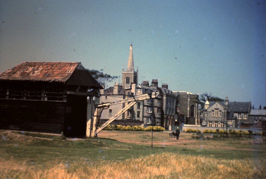
Harwich became an important naval base in the 1660’s, and Samuel Pepys was First Secretary to the Admiralty at this time and also the town’s M.P. The Navy Yard was the original site of one of the town’s most impressive surviving monuments, the Harwich Crane, dating to about 1667.
Treadwheel Crane
The unique Treadwheel Crane, built at the shipbuilder’s yard in 1667. It was operated by two men walking inside twin wooden treadwheels and was in use until the early years of the 20th century. It was re-erected on Harwich Green when the old shipyard was dismantled in 1928. In the 18th century quieter times returned but civilian shipbuilding continued in Harwich and fishing was still an important industry. Harwich was also a still a busy little port. However the town did suffer from flooding at intervals.
In the 1720s the writer Daniel Defoe visited Harwich and he said it was ‘a town of hurry and business, not much of gaiety and pleasure; yet the inhabitants seem warm in their nests and some of them are very rich’. Defoe was also impressed by Harwich harbour. he said it was ‘able to receive the biggest ships and the greatest number that ever the world saw together’.Harwich Guildhall was rebuilt in 1769.
Harwich and the Cobbolds
The advent of brewing at the Cliff in Ipswich in 1746 is well documented as is the vandals’ torching of this ancient building in February 2020. Also widely known is that Thomas Cobbold (1680-1752), a maltster from Bury St. Edmunds started brewing in Harwich about 1723. The exact site of the enterprise is not clear but it was certainly right on the waterfront. One source describes it as in Kings’ Quay Street behind the Cups Hotel and another as roughly where the Pier Hotel and Quayside Court now stand. Problems with the quality of the water (it was said to be too brackish) unquestionably led to the building of the new brewery in Ipswich, with abundant good water from Holy Wells, but what is not so well known is what happened to the Cobbold brewing interests in Harwich thereafter.
The founder’s son, also Thomas (1708-1767) oversaw the new Ipswich venture but it was by no means the end of his activities in Harwich, after all he owned a number of inns and was probably supplying Landguard Fort as well as Royal Navy ships. The seaman’s beer ration was a gallon a day so it was a significant market. It seems that the water problem was one of quantity as well as quality. Good fresh water was available from inland but only in limited quantities and at a price.
Further evidence of this Thomas’ activity is provided by his opening of a seawater bathing establishment in 1754 in competition with one opened recently by Thomas Hallsted. It became known as the Brewer’s Baths and clearly flourished as Thomas was able to buy his competitor’s baths and one of his inns, the Three Cups. Under the terms of his will, the brewery in Ipswich passed entirely to his son John (1746-1835, known as ‘Big John’, partially on account of his propensity for reproduction – he had 22 children!) but the Harwich brewery was leased to Big John and Charles Cox for 14 years. Charles Cox (1731-1808) was an influential Harwich business man, being Mayor of Harwich six times and had a gentleman’s agreement with Big John that whilst he, Big John, managed the Ipswich brewery he, Charles would manage Harwich. The agreement was formalised in 1788 and saw the beginning of a Cox-Cobbold partnership, which later included banking and survived for many years.
In 1803 the partnership obtained permission to pipe water to the brewery from its well in Dovercourt but by this time Charles Cox was elderly so his interests were taken over by his son Anthony, and Big John’s by his son Thomas (1780-1845). Both were very active in the business and civic worlds, Thomas joining Anthony on the list of Mayors in 1828, 1832 and again in 1843. The year of Big John’s death, 1835, saw the start of the Cox – Cobbold banking business (following the banking crisis of 1825 which broke many regional banks but which also offered opportunity to wealthy investors) and led to the entire Cobbold brewing business in Harwich being offered for sale two years later. However, this was not the end of Cobbold brewing in Harwich as the old workhouse had come up for sale in 1836 and was bought by the Cobbolds for conversion into a brewery which suggests that the Cox – Cobbold relationship was now focussing on banking whilst the Ipswich Cobbolds were investing in a smaller enterprise in Harwich to be run as an offshoot of Ipswich. This arrangement continued until Cobbold brewing ceased in Harwich in 1871, some 148 years after it had started.
Thomas (the three times Mayor) had retired and built himself a fine house, Holly Lodge in Dovercourt, overlooking the River Stour where he died in 1845.
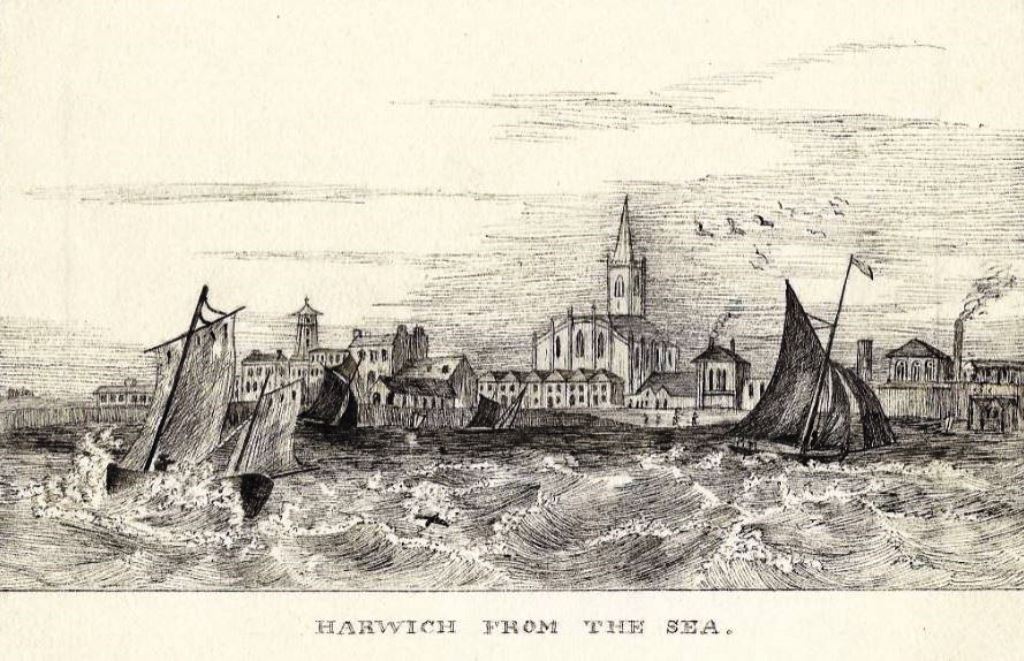
An old engraving, shown as Plate 1, shows the brewery to the right of St. Nicholas’ Church which was rebuilt in 1822. This must be the original brewery as the engraving is dated 1830/31
Harwich from the Sea (Plate 1)
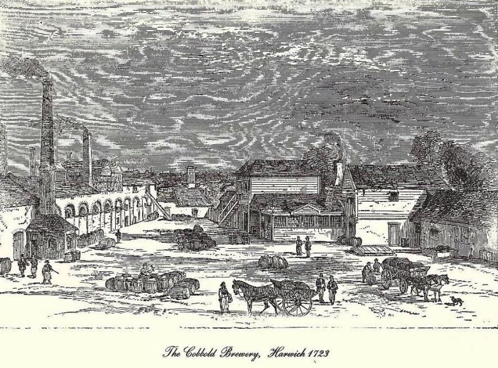
Another old engraving, shown as Plate 2 is captioned ‘The Cobbold Brewery, Harwich 1723’ but there is no evidence to support the caption. It may well be the Cobbold Brewery but the date is questionable. Does anyone have any evidence of date or who the artist was please?
The Cobbold Brewery (Plate 2)
The author of this piece is Anthony Cobbold, Keeper of The Cobbold Family History Trust. His principal sources are trust records and Richard Oxborrow’s research 2004.
If you know the answer to the question posed above Anthony would be delighted to hear from you at anthonycobbold@tiscali.co.uk
Town structure.
The urban structure of the Harwich peninsular has developed around three defined centres, each totally different from the others in both Character and layout.as they have followed one another in development so they are now saves out in a sequence along the narrow hook shaped strip of land. Linking them but also dividing them is the main A604 trunk road which terminates at Harwich Quay.
Old Harwich
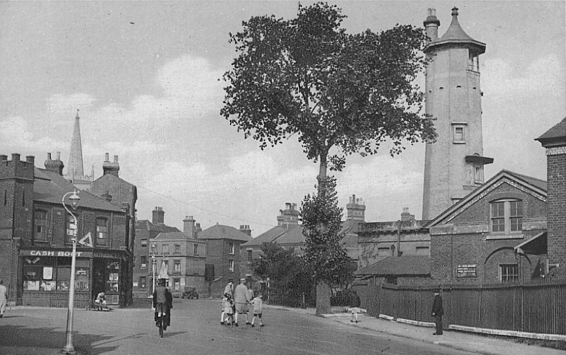
Entrance to Harwich
Anyone who spends a little time exploring the quiet old streets of Harwich could hardly fail to be impressed by the wealth of buildings which recall the town’s past importance, as a trading port, a naval base, and as a bastion of Britain’s front line defences in times of war. Beneath the town’s street, however, lies a vast source of information which can enable archaeologists to trace human occupation much further back in time.
The old town has long been associated with the sea, but it is not until one turns into West Street, almost at the very end of the narrow peninsular that one is aware that the sea is anywhere near, the town has developed around four main streets which run roughly parallel down to the quayside. Linking these together is a series of narrow streets and alleys. Subsequent development has softened the regularity of the street patterns, but not changed the basic town Structure.
Leading Lights
The entrance to Harwich old town is dominated by the High lighthouse which Stands at the south end of West Street.
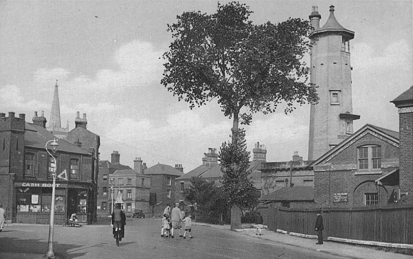
High Lighthouse
There have been three pairs of lighthouses through the ages, from the original wooden pair, which no longer exist, and then the brick built ones that still stand in Harwich, to the cast iron ones that still stand on Dovercourt Seafront. None of these existing lighthouses are used for navigation purposes today.
The brick lighthouses in Harwich were built in 1818 under the supervision of John Rennie Senior to replace earlier wooden ones. They belonged to General Rebow who became very rich by charging 1d per ton light duties on all cargoes coming into the port. But in 1836 Trinity House (TH) acquired the Harwich Lights from General Rebow for £31,730, there being 12 years and 5 days remaining of his lease. It is suspected that Rebow had become aware of the changing course of the channel.
The lighthouses became redundant in 1863 for just this reason and the new cast iron lighthouses were erected at Dovercourt opposite the present tennis courts. The High Lighthouse continued to be used by mariners as a landmark. In 1909, the High and Low Lighthouses were sold to the Borough Council. The Low Lighthouse was vested in the Harwich Corporation for 10/- (50p), but with the condition that it should be returned to TH if needed for navigational purposes. TH in fact took it over again in 1970 and converted it into a pilot signal station. In 1974, it reverted to Tendring District Council (TDC) on completion of the new Pilot Station at Angel gate. It became the Maritime Museum of the Harwich Society in 1980.
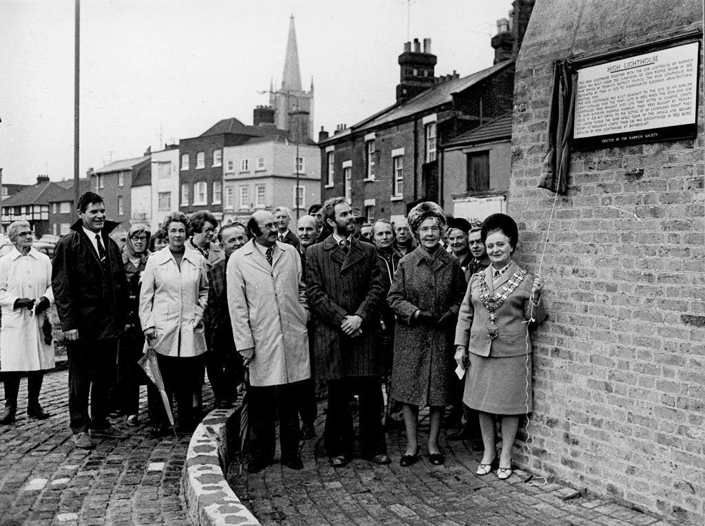
Plaque Unveiling 1976
October 30th 1976 saw the unveiling of our plaque on the High Lighthouse at Harwich. The morning was cold and drear but it did not deter about fifty faithful members from attending the ceremony which was performed by the Mayor of Harwich, Councillor Mrs Georgina Potter, Also present were the Chief Technical Officer of Tendring District Council, Mr C. Bellows, and Mr Henry Lambon and Mr Tom Judson, chairman and secretary respectively of the Colchester Branch of the Royal Institute of British Architects.
The restoration of the High Lighthouse was a joint undertaking of Tendring District Council, Essex County Council and the Colchester Branch of the R.I.B.A. to commemorate European Architectural Heritage Year, and was the first major undertaking of the new Tendring District Council to give a lift to depressed Harwich, and what an excellent job they have made of it!
Winifred Cooper – Harwich Society Highlight Magazine 1976
The widest and longest street in Harwich is West Street and it is particularly important since it is from this street that the town tends to be judged by casual visitors and ferry passengers. The guildhall is the only building in Harwich old town of outstanding merit on its own, it was rebuilt in 1769, the interior contains a good staircase and a Panelled court room.
Opposite the guildhall was the Three Cups hotel which was built early in the 16th century on an L shaped plan and has a 17 century wing. Inside there is a late 15th century staircase, moulded beams and a late 16th century plastered ceiling.
Perhaps the most pleasing townscape exists around the church of St. Nicholas .as one travels down church street ,the road gradually tapers From the guildhall, which is a string visual buttress, standing forward into The street ,causing ones view to stray.
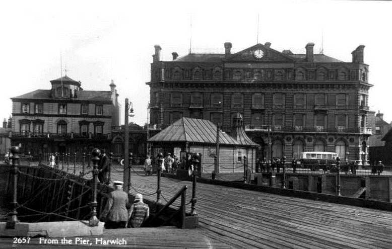
The other buildings on the quay are the Pier Hotel which is a mid-19th Century stuccoed building in the baroque style and the very austere town hall now residential apartments. This was originally built as the Great Eastern Hotel in 1864 and is a monumental composition in free mixed Italian style. The octagonal ticket office and the connecting booking hall on the edge of
the quay was originally the ticket office for the continental packet steamers , and is an elegant and fascinating reminder of the early days of cross Channel travel.
Harwich Fire Brigade
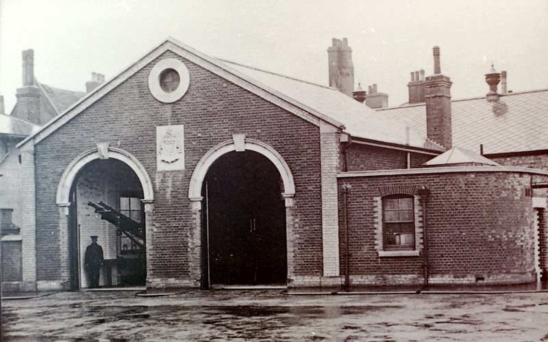
At the turn of the century the Fire Station was at the rear of the Three Cups Hotel with equipment consisting of a Shand Mason steam pump and a second smaller pump. The press commented: ‘The spectacle of a messenger running off to summon the brigade of 16, from 16 separate homes, is sure not more ridiculous than the old pump which, once working, won’t throw enough water to draw a fly a few yards.’ The hose, apparently, had so many leaks in it that it was useless. They did not have a single ladder at their disposal and had to borrow hoses from the GER and the Army. to their credit, the Council did act, and they recommended the building of a new fire station, ironically on the site of the disastrous Parson’s fire and the purchase of a horse-drawn steam engine. It was suggested that a horse-propelled fire engine be purchased and a fire station be built on the vacant land next to the new Electric Palace cinema where two cottages had been.
A vacant house on the corner of Wellington Road and Kings Quay Street would become the station officer’s house. The council accepted Mr Newton’s tender to build the new fire station at a cost of £ 1041. The new fire engine arrived in November before the fire station had been completed. The new Shand Mason equipment could be fired up in seven minutes and was capable of throwing 300 gallons of water a minute, almost three times the amount of the old pumps.
Following the destruction of some cottages belonging to the Corporation by fire in 1911, it was decided to use the £ 942 received from the insurance to build a new fire station on the site and lease the remainder for a cinema at £ 30 per annum for 60 years. When the new fire station opened in 1912, Mr Dixon Hepworth became captain of the brigade which was equipped with the latest Horse Propelled Steam Fire Engine. It stood next to the Electric Palace.
Until 1915 horses were hired to pull the engine, the council then bought two horses of its own for £ 50. This lasted until 1925, when the council sold the horses and bought a Dennis motor fire engine for £ 960.
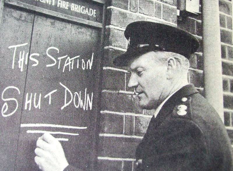
Moving-Out day at Cow Lane
Bearded labourers sporting a helmet as their uniform, pulling hand pumps through the narrow streets, and smartly dressed “Keystone Cop style” firemen whipping up their horses in a frenzy of activity as the church bells sounded the alarm. The old fire station on Cow-lane, Harwich, has seen them all, but now the borough’s final link with those far-off days of the early fire brigade has moved to a smart, new station in Fronks-road, Dovercourt. Station officer J. Howard, chalking up the sign which marked the official closing of the old fire station.
Modern Harwich
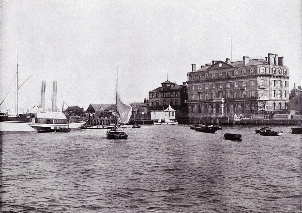
Great Eastern Railway Hotel
In 1801, at the time of the first census Harwich and Dovercourt had a population of about 2,700. To us it would seem no more than a village but by the standards of the time it was a fair-sized market town. In the years 1808-1810 a redoubt was built to protect Harwich from the French. A lighthouse was built in 1818 and St Nicholas Church was dedicated in 1822. In the early 19th century an industry making ‘Roman cement’ flourished in Harwich although it had died out by the end of the century. On the other hand the railway reached Harwich in 1854 and steam ships began sailing from the port. Furthermore there were some improvements in Harwich during the 19th century. from 1870 Harwich was lit by gas and in 1880 the first sewer was dug. in 1887 Harwich gained a piped water supply. In the early 20th century the fishing industry in Harwich petered out but the port continued to thrive.
Today Harwich is still a flourishing port. In the 20th century Harwich continued to grow steadily. By 1911 it had a population of over 13,000. By 1971 it was almost 15,000.
Today Harwich retains much of it’s history, maritime links and old buildings, such as the Redoubt Fort, High and Low lighthouses, and the Electric Palace Cinema. There are numerous lovely old houses to be seen along the narrow streets including the Foresters house which is said to be the oldest house in Harwich.
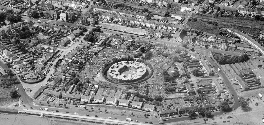
The Redoubt was built between 1808 and 1810 to protect the port of Harwich against the threat of Napoleonic invasion. The Redoubt is of circular shape, approximately 200ft in diameter, with a central parade ground of 85ft diameter. Hoists were used to lift shells from the lower level to the gun emplacements. Though difficult to imagine as it is now surrounded by houses, when the Redoubt was built it was on a hill top with free views in all directions. A house was demolished to make way for the Redoubt, and a large elm tree – used by ships as a navigational mark was also removed.
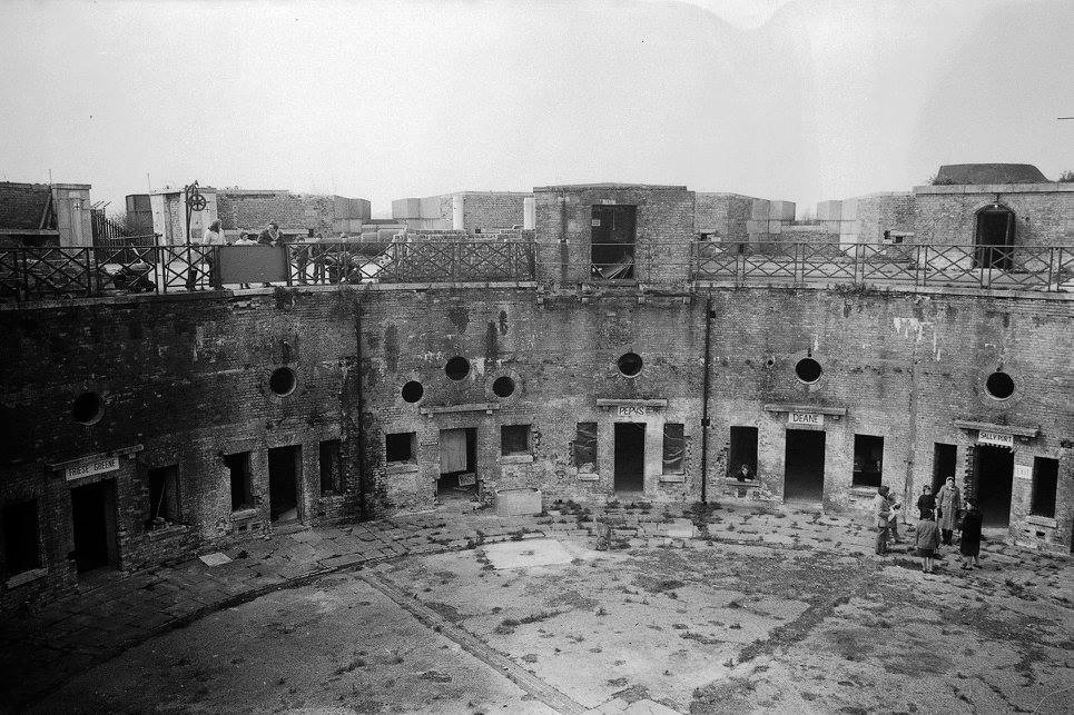
Redoubt Fort
Originally armed with ten 24-pounder cannon, the Redoubt was remodelled in order to accommodate increasingly heavy guns, as technology and the perceived threat changed. In 1861-2, work was carried out to accommodate 68-pounder cannon, and the emplacements were strengthened by adding granite facing to withstand improved enemy artillery. Only a decade later in 1872, three of the emplacements were altered to take enormous 12 ton RML(Rifled Muzzle Loading) guns. In 1903, three emplacements received 12 pounder QF(quick firing) guns.
Despite this ongoing modernisation, the Redoubt never fired a shot in anger. It is also probable that its strategic importance declined towards the end of the 19th century with the construction of the more powerful Beacon Hill Battery just to the south. In the 1920s the area around the Redoubt – previously kept clear to provide fields of fire – was bought by the Town Council. This land is used for allotments. The Redoubt itself was allowed to fall into disrepair.
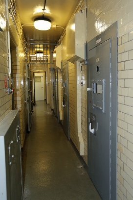
The Redoubt was briefly taken back into military service during World War II, when it served as a detention centre for British troops awaiting trial. Examples of the graffiti left by the soldiers can still be seen in some of the rooms.
Following World War II the Redoubt was used by the British Civil defence organisation who used it until they were disbanded. That was the end of the Redoubt’s military service.
Harwich Police Station
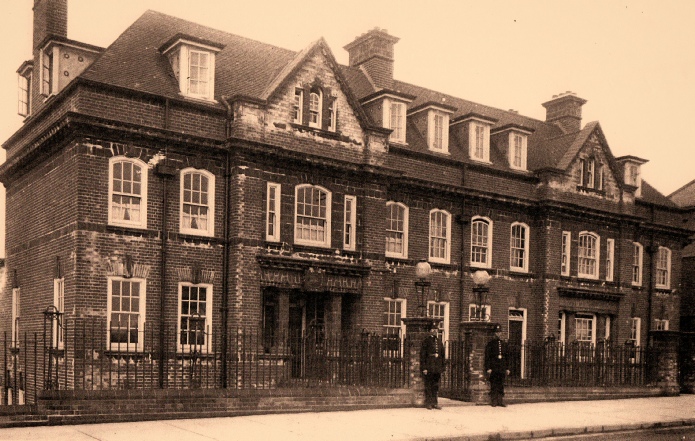
The importance of Harwich changed significantly with the arrival of the railway station in 1854 and later in 1883 when Parkeston Quay was opened. Probably it was the significance of the town to travellers and the increase in population which prompted the need to build such a substantial new Police Station complex. The site was designed as a self-contained law enforcement centre complete with court offices and accommodation for many police officers.
Plans for the proposed new Police Station were drawn up by the County Architect, Frank Whitmore in April 1913 and copies of some of the plans hang today on a wall within the building. This purpose built Police Station comprised of a basement, first and second floors and a roof space, referred to as the attic and part of this was as single Police Constables’ Quarters.
The Basement was divided up into various rooms to house the resources necessary to run such a large complex. These included a Weights & Measures Room, 2 Wash Houses complete with toilets, Store Rooms, and a Bicycle Store.
A block of terraced houses was created at the back and to the west of the Police Station which accommodated three married constables and one married sergeant. The accommodation was quite large, each house having a kitchen, pantry and living room on the first floor, two bedrooms on the second floor and a third bedroom in the attic of the roof space. The kitchens, living rooms and first two bedrooms were quite large, all measuring 13′ 6″ x 12′ 0″.
Detention room and four Prisoner Cells were constructed to very strict security guidelines. A Magistrates Court was built at the south end of the building but this was later demolished after being relocated within the Harwich Town Hall complex on the quay. Gardens were created to the west of the main building along with a grass slope along the front of the building from the pavement down to the basement level. A small footbridge, flanked by two pillars at the entrance and adorned by police beacons, crossed this slope from the pavement to the public entrance of the Police Station. A similar footbridge, flanked by just two pillars, connected the pavement to what used to be the Inspector’s accommodation to the north of the building. The Sergeant’s accommodation was built adjacent to this with access via steps from the basement level at the front and rear. A fence was built along the South-east boundary of the site and walls were built along the North-west and South-west boundaries.
By Kind permission of Richard Kirton – 18th March 2014
Bathside
Unlike the previous three areas around which the town has developed.
Bathside is not a natural centre but a clearly defined residential unit with a strong social character and so is therefore worthy of comment. The physical barriers which contain and define the area, the railway to the south east and the mudflats to the North West, are extremely strong. The railway, although bridged by level crossings, divides Bathside from the town beyond and therefore essential facilities which service the Area.
The steep earth bank, which runs along North West perimeter, Shelters the area behind from the wind which blows across the open expanses of mudflats.
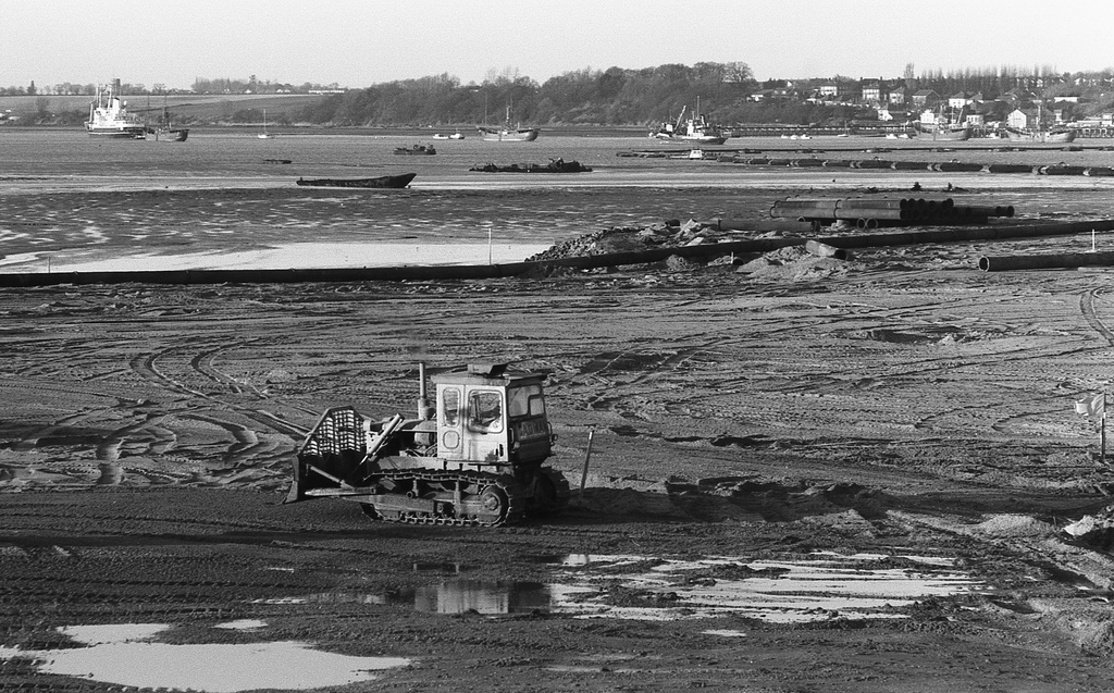
The railway, built in 1854, came before the houses which followed several Years later as the street pattern which conforms to the subsequent shape of the area, suggests Bath side derived its name from the baths which were located out on the Mudflats .these baths were originally set up in 1761, but with the coming of the railway which cut them off from the town beyond, and the opening of the rival baths in Dovercourt by Tolly Cobbold, the brewers, they steadily Declined and soon ceased to exist.
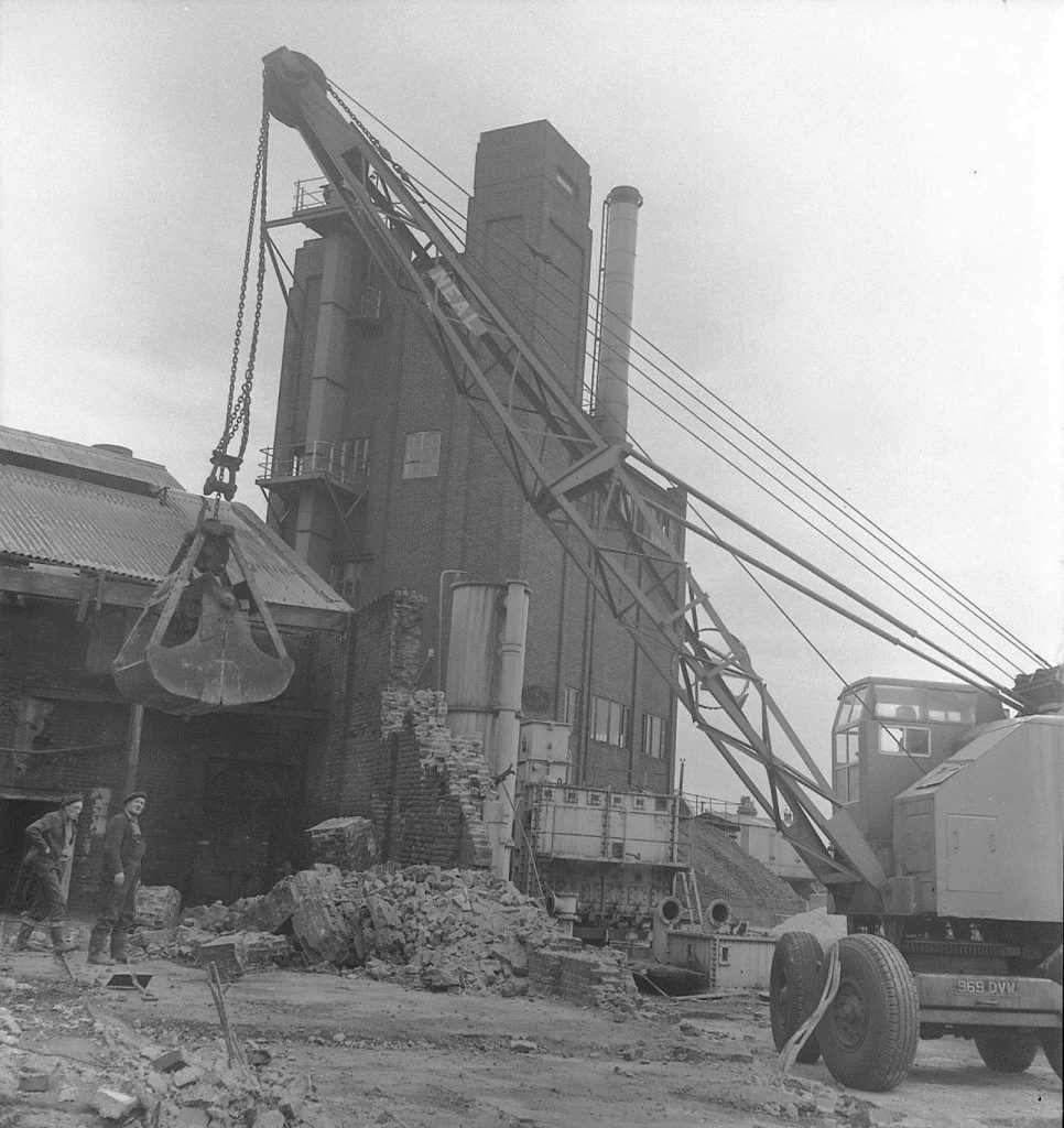
Gas Works
At one time, bathside supported a variety of small industries and commercial concerns. they had several slaughter houses at the south west end which have all now disappeared, a shipyard, a coalyard, sawmill, soft drinks factory and the gas works.
Much of the decline of the industrial and commercial activity can be attributed to the 1953 floods which devastated the whole area, but caused Particular hard ship to bath side which lies very near sea level. During the floods the entire bathside was evacuated, and many of the Population, especially the young families never returned, preferring to remain in the developing outer areas of Dovercourt.
Lower Dovercourt
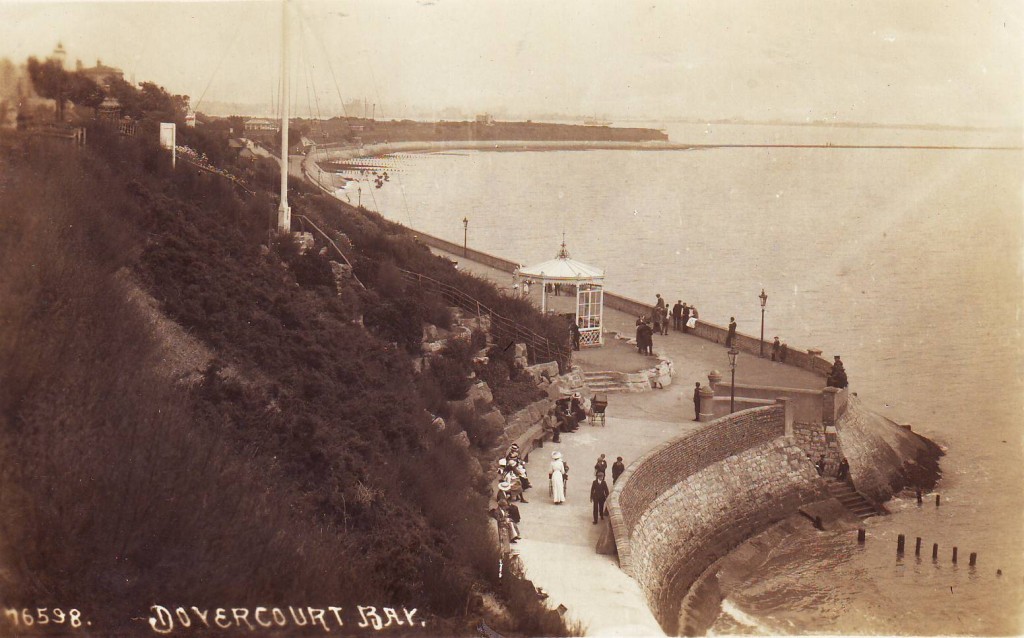
Dovercourt Bay
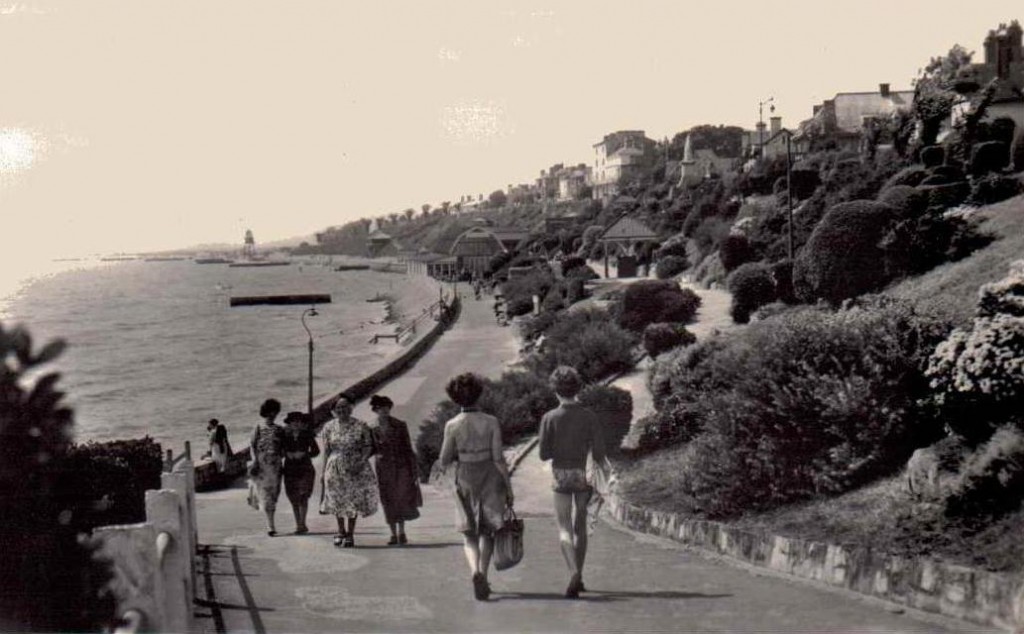
In 1863 Trinity House erected two cast iron lighthouses on the beach. They were used until 1917 to guide ships around Landguard Point; the two lights aligned indicated the right course. the deep-water channel is now marked by buoys. the lighthouses were restored in the 1980s and are sometimes known as Dovercourt Range Lights. The Lighthouses are 150 yards apart and were leading lights, they worked as a pair; with one light positioned over the other. the vessel was then on the correct course.
The Low Lighthouse is a 45ft (16.5 metre) high, ten-sided tower of brick. The ground storey has a projecting canopy to provide public shelter. The High Lighthouse is a 90ft (32.8 metre) high, nine-sided tower of grey gault brick.
The lighthouses were built 9ft (3.3 metre) to the south west of the original sites. The old wooden Low Lighthouse was built by the beach and is portrayed in one of Constable’s paintings. The High Lighthouse was over the Town Gate (on the Felixstowe side of the present High Lighthouse). Both earlier lighthouses were coal fired.
As a fashionable 19th century Seaside resort and spa town it drained Harwich old town of most of its Wealth. as Dovercourt became more fashionable so Harwich became less so, And as the poorer sections of the population remained so the quality of the Environment in the old town deteriorated. The high street and the promenade run parallel, almost immediately behind one another with the advantage of giving the visitors staying in the Hotels along marine parade easy access to both pleasant beaches.
The main road, whilst being sheltered from the weather, is also sheltered from a view of the sea. Although from the junction of high street and Kingsway, the sea is barely 100 metres distant; one remains totally unaware if the saltiness in the air Dovercourt has the atmosphere of a reasonably prosperous small inland Town, with little evidence of its proximity to, and close association with The Sea appearing along the high street.
At the end of lower Dovercourt are the pleasant formally laid out paths and gardens of Cliff Park. Linking with the promenade behind, this too has an excellent view of the sea,
But the sight rise in the land away from the road denies passing traffic All knowledge of existence.
Upper Dovercourt
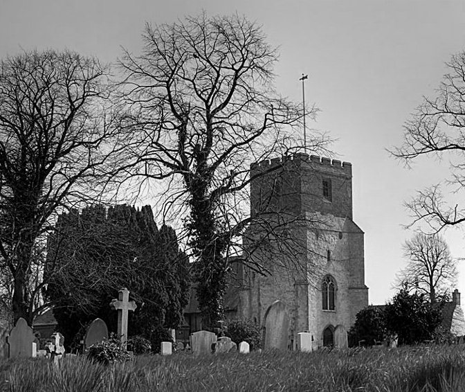
The original centre, now known as upper Dovercourt developed inland with no direct access to the sea. On the route in to town this is the first area of positive identity through which one passes .the green and the Mediaeval church of All Saints are
Much as they were 1000 years ago. The homes have changed, and the road has been improved but the centre still retains something of its Original village atmosphere. The actual fabric of upper Dovercourt has developed as a strip alongside the main road .beyond most of the strip is open country.
The spreading Residential development, threatening at the far end to engulf it, has been generated by the development of lower Dovercourt.
Thinking of Home by David Ling.
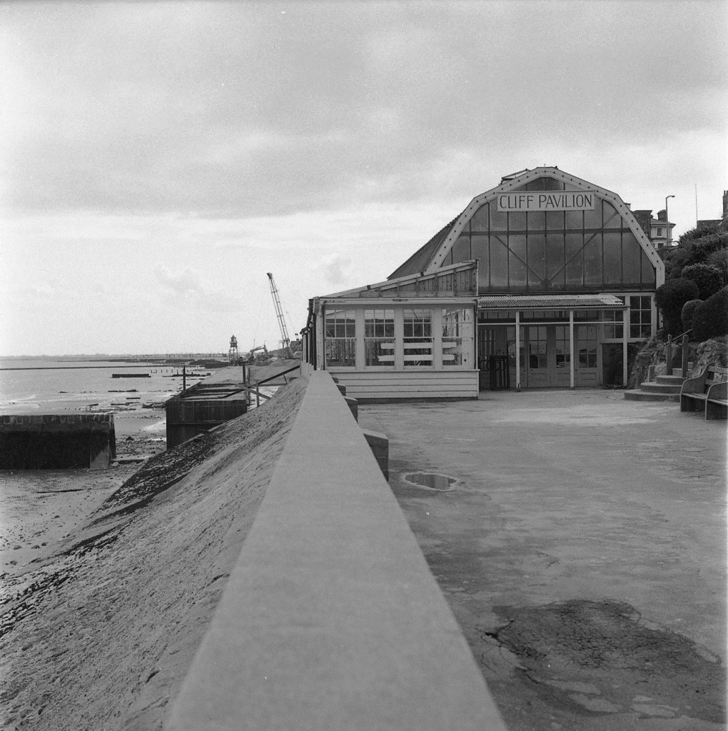
Cliff Pavilion
Take me back to England – take me back today
To the town where I was born – how I miss old Dovercourt Bay.
Take me to the lighthouse – I can smell the seaweed there,
Take me along the windy prom to tangle up my hair.
Just about here I’m thinking the Cliff Pavilion stood,
With Queen Victoria watching on in a very sombre mood.
Twas here just fifty years ago I met my future wife
At a summer dance on a Saturday night the luckiest day of my life.
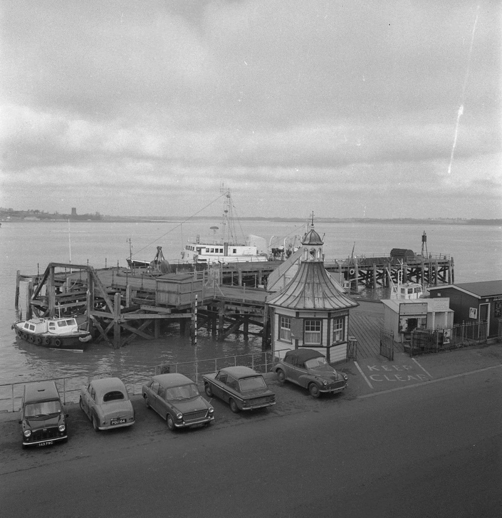
Ha,penny Pier
Then on to the Spa – into the park to watch the squirrels play
A go on the swings and down the slide, then be on my way.
A bit of a hike to take a line and fish off old Stone Pier
But for all I ever caught there they didn’t have much fear.
Then onward down to Harwich where we used to moor our boat
Where I watched her go down in a gale one day, she lost the will to float.
Just past the wharf to Ha’penny pier where we used to catch the ferry,
To Shotley or to Felixstowe for a day of making merry
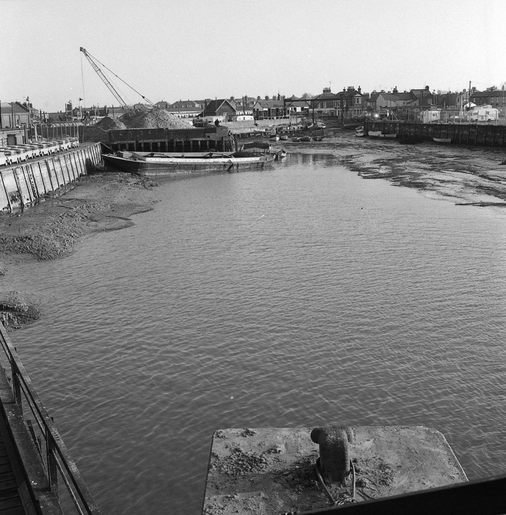
Gas House Creek
Watching trawlers coming and going alongside the Trinity ships,
The follow your nose up a side street for delicious fish and chips.
Round the corner to Gas House creek and the railway ferry crane
That my father once worked when I was a boy and aspired the same
Through Bathside past the sinky mud to a railway bridge by the sea
As a nine year old a most beautiful sight having been an evacuee
Then up to Dovercourt High St, past the lights to look at a place
Where I worked for ten years in my twenties and recognised every face

Sledging down the hangings
On up the hill where the Regal once was – next to my first high school,
Where the French teacher gave me my nick name for acting like a fool.
Down the lanes to the back of the school was the daunting Toboggan Hill,
On the few snowy days in winter sledges flying what a thrill.
Now I’ll look over to Parkeston Quay to watch the ships sail by,
After that stroll through the Hangings at dusk when bats invade the sky.
I’ll head out westward to Copperas Wood, bluebells there to pick
And on Wrabness foreshore where the tide comes in so quick,
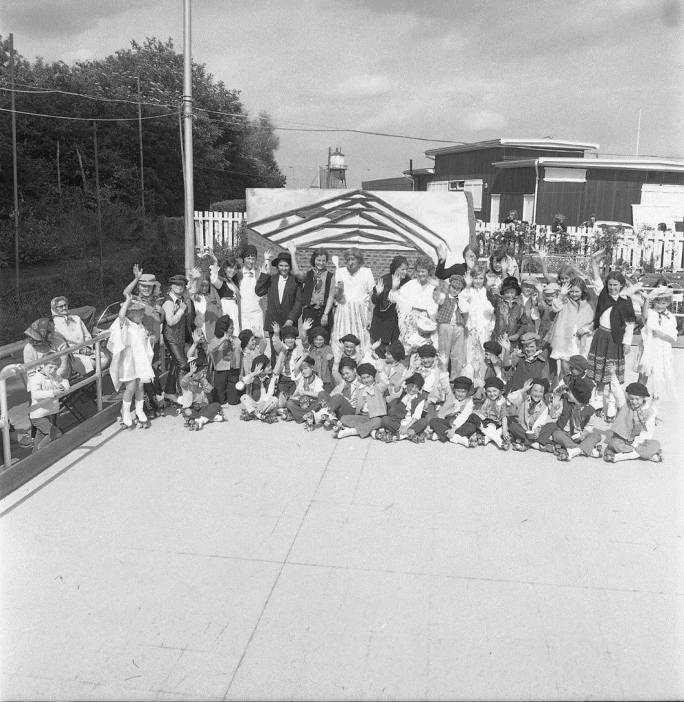
Skating Rink
Then I’ll make for the Wix Wagon pub through pretty country lanes
And down a couple of English ales to soothe away my pains.
Meadner through some winding roads to Oakley Little and Great
Into Mayes Lane to Ramsey church and Chafford where my mate
Spenty many years there cooking for the boys of the school.
They used to have a smashing Fete though it rained as a rule.
Through Tollgate past The Devon and onto Dovercourt Green
Where if you’re lucky daffodils to make floral scene.
The Memorial – the water towers – then wander down the Drive
The Skating rink – Putting green, the Boating Lake that I’ve Dreamed about quite often in the years I’ve been away, Then I’ll be back where I started on my Odyssey today.
As Harwich and Dovercourt continues to change and grow, so will our knowledge and understanding of its history.
We are adding more information to this site on a regular basis, if you wish to submit any photos or provide any information, please use the contact page at the bottom of the screen.
Acknowledgements:
The Harwich Society
